12/21/14

Albright Loop/A.T./Humpback Rock - December 20, 2014

 submitted by Barbara Martin

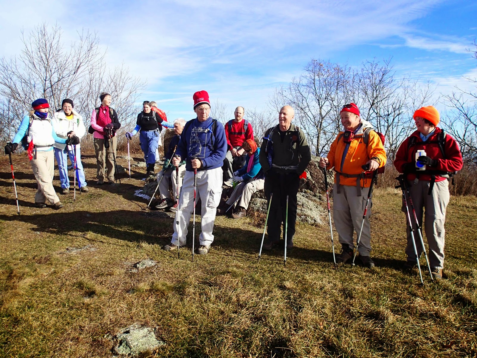
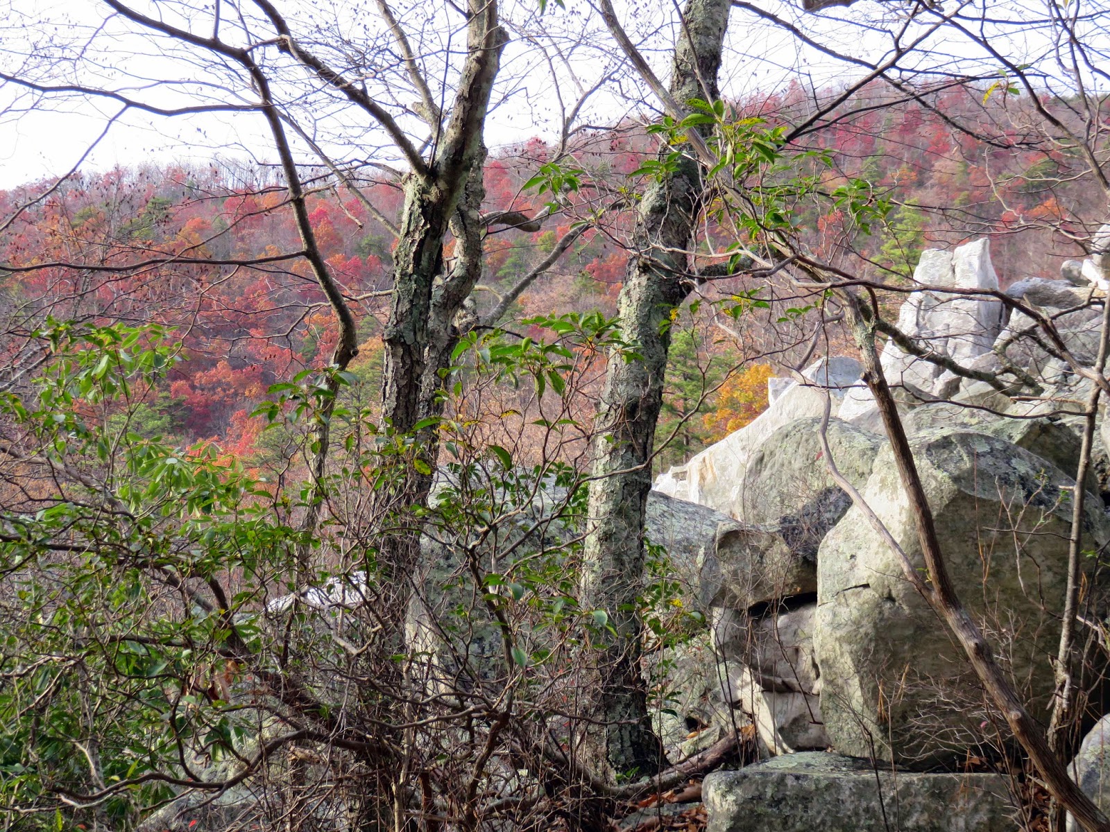
Barbara Martin co-lead a circuit hike from Humpback Rock parking lot with Andy Wilgruber.  This was Barbara's third hike as co-leader and she was anxious to earn her PATC hike leader "badge".  Andy arrived ahead of schedule with a group of 10 including Lindsay Brown, Pete and Bev Fink, Wanda Hamler, Leon Gorman, Suzanna Williams, Jeanne Densmore, Dan Ralston, David Crowe and C J Woodburn.  Barbara and Claire Cline met the group at the parking lot.  We hiked the Allbright Loop Trail to it's intersection with the Appalachian Trail south.  Although Dan tried to dissuade Barbara from her intended route we proceeded according to plan on the AT south.  We made our first stop at the Glass Hollow Overlook with an amazing view of the Rockfish Valley.  We hiked another 4 miles with respectable elevation to the intersection of the blue-blazed trail to Humpback Rock.  Everyone's stomachs were grumbling at this point, so there was a rush to the Rock to have lunch, which included Newtown Bakery cookies brought by Barbara and a great assortment of candy brought by Andy.  Although it was calm on Humpback Rock we grew quickly chilly and descended to the parking lot, carefully avoiding large icy patches.  It was a wonderful winter solstice eve hike.


12/18/14

Riprap Hollow - December 16, 2014

Mark Perschel, Barbara Martin, and Scott Davis at the start

Horsehead and Trayfoot Mts.
Barbara Martin met Marit Anderson, Mark Perschel, and Scott Davis at Rockfish Gap and led us to the valley trailhead for the Riprap Hollow circuit hike.  It was an interesting approach to come up from near Crimora Lake off of Rt. 340, and it also added a few miles to the circuit making it an 11.3 mile hike.  Barbara (leader) had a nasty fall over the weekend, so she helped us start the trek and then turned back after the second stream crossing.  Marit took charge and continued with the intended route from the Riprap Trail, up to Chimney Rock, past Calvary Rocks, and in the Shenandoah National Park along the Skyline Drive where we had lunch on the Appalachian Trail.  Paine Run provided small falls, pools, and at least 4 stream crossings. Our highest point was at 2,997 ft. with views of Horsehead Mountain, Trayfoot Mountain, and the Shenandoah Valley.
Marit and Scott amongst the many rock formations
      The second half of the day we continued two miles south on the AT and then descended down Wildcat Ridge Trail with much evidence of the three fires of the 1990's.  There was an understory of mountain laurel, azalea, sassafras, and catawba rhododendron.  We need to go back in late May or early June to see these thickets in full bloom. Turkeybeard was another interesting plant we saw, a relative to the Western bear grass. A summer outing would also allow us to swim or wade in the many pools. Gotta go back!
    
Scott perched on Calvary Rocks
We finished by reuniting with the Riprap Trail and recrossing the streams of the Paine Run watershed on our way back to the cars. Six hours of hiking and we experienced rain, snow, ice, fog, and sunshine.  All in all, a fine day in the mountains.

 submitted by Marit Anderson

12/3/14

Turk Mountain/Morman River - November 22, 2014

We had a great turnout for a hike with 2 options.  Barbara Martin and Dan Ralston led a 10 mile Turk Mountain/Morman River circuit hike and Bill Holman led a shorter hike.  Both hikes started at Jarman Gap in Shenandoah National Park.  We were blessed with a nearly perfect day--dazzling blue skies, a bit of nip in the air that became warmer as the day progressed.  There were eleven in our group, a combination of old timers:  Barbara, Dan, Leon Gorman, Kelly O'Rourke, Jeanne Densmore, Dave Burszich and Michael Seth, two newcomers, Mike Neillo, who drove to meet us all the way from Reston, Linda Scandore, who hikes with the Senior Hikers frequently and has completed 1000 miles of Camino de Santiago in Spain and Ned May, who has joined the group once before.  We headed north on the A T and then took a spur trail to the glorious viewpoint on Turk Mountain, where we had lunch.  Luckily there was very little wind on the rocks, making for a pleasant break.  Barbara took her responsibility as hike leader seriously and brought out home-made peanut butter, chocolate chip cookies, which were devoured quickly.  We returned to the AT on the spur trail and headed north again, crossing Skyline Drive for the second time, which Barbara kept referring to as the Blue Ridge Parkway, confusing everyone.  At this point we headed down, down, down on the Turk Branch Trail with several pretty stream crossings, until we intersected with Morman River Fire Road.  Then it was a steady 2 mile uphill climb back to the parking lot.  The last half of the hike was on a nice wide trail leaving plenty of opportunity for conversation and future hike planning.


12/2/14

Turk Gap to Jarman Gap - November 22, 2014

submitted by Iva Gillet

On the lovely sunny Fall day, 8 hikers preferred Bill Holman’s shorter hike option of ½ the distance of Barbara’s hike. So Lindsay Brown, John Shannon, Marian Styles, Brian Muszynski, Wanda Hamlin, and Iva Gillet joined Eric Bredo, home for a weekend visit from Canada, on the 5 mile hike option. We enjoyed the descent from Turk Gap through the rustling leaves. At one of our snack breaks, in response to the pre-hike advisory of carrying 2 liters of water, Brian was concerned that he hadn’t brought so much on such a nice day. Eric mentioned that perhaps Gunga Din could bring him some water, prompting a discussion about this Rudyard Kipling poem of a boy who carried water in a goat’s skin. Since none of us were dehydrated, we continued to the Fire Road where we had lunch. Since we were finished lunch at noon, Iva proposed a slightly longer detour to allow for another ½ hour of hiking, so we headed toward Blue Hole and the Sugar Hollow Reservoir as a short out and back. Upon returning to the lunch spot, Bill herded us up the fire road to Jarman’s Gap. Brian was able to sell John Shannon’s handmade wool hat back to him for 2 cents, after finding it and conducting a quick auction.  Since we had a quick group of hikers, we returned to Jarman’s Gap by 2 PM and then headed off to our various afternoon and evening activities. 


Cold Mountain - November 15, 2014

submitted by Iva Gillet

Bill Holman shepherded 14 hikers on this circuit hike at the amazing Mt. Pleasant Scenic Area during lingering high leaf color. The group hiked clockwise through the apple orchard and Boy Scout campsites and enjoyed lunch at the AT Cow Camp Gap shelter before the steep climb up to the AT.  The views from the AT were unobstructed.  Upon arriving at the wide open vista the group paused for a snack and to enjoy the 360 degree views.

Hikers included: CJ Woodburn, David Crowe, Leon Gorman, Susanna Williams, Brian Muszynski, Karen Ramsey, Wanda Hamlin, Claire Cline, Pete and Bev Fink, Rich Bard, Jackie Nasca, and Tom and Ellen Shields.


11/20/14

Old AT-New AT Loop from Three Ridges Overlook - November 20, 2014

Claire Cline, Kelly O'Rourke, Anne Colgate, Marit Anderson (hike leader)

Mark Perschel, our lone male companion
 submitted by Marit Anderson

Five hikers came out on Thursday, November 20 to brave the cold temperatures and enjoy the 8.2 mile loop from Three Ridges Overlook connecting the old Appalachian Trail to the new Appalachian Trail. We left the Blue Ridge Parkway at 2600 ft. and climbed into the woods following the 30 year old white blaze markers up into Wintergreen. Coming out at Cedar Drive and 3600 ft. we followed the red blazed Perimeter Trail/Old Appalachian Trail markers.  Much of the path had clear views of Torrey Ridge and the Shenandoah Valley.  Gorgeous this time of year...and why we like winter hiking- great vistas, invigorating weather, and no insects!
We saw lots of ice flows and carefully climbed over icy patches
Lunch on Cedar Cliffs about halfway, which is right across the way from Dripping Rock and where the old AT intersects the new AT.  We continued south towards Three Ridges Overlook for the next few hours.

Claire, Mark, Marit, and Anne stopped for wine tasting at Wintergreen Winery on our way home

11/14/14

Fortunes Cove - November 1, 2014

Hike leader Kelly O’Rourke- was joined by veteran’s Dave Borzych and John Brandt and new hikers Claire Cline and Patrick Doyle (new to C-ville) to enjoy a nice hike at Fortune’s Cove. We were fortunate (J) that it did not rain…chilly at the top so lunch was not a long. Still we all did both loops for a total of 8.3 miles with a total elevation +2223 according to MapMyHike GPS tracker. After the hike we stopped at the nearby winery Mountain Cove (they said they are the oldest winery in VA).


11/11/14

Devils’s Marbleyard - November 8, 2014


Reported by Iva Gillet

      How does a temperate, sunny Fall day climbing up 1650 vertical feet of rock and boulders in a mile, followed by an hour of bushwacking BEFORE lunch sound to you? If this is your kind of fun, Pete Fink’s hike would be the one for you. Though clearly not a hike for everyone, the 5 hikers who headed out on this chilly morning with an 8 AM start time were very glad they spent their Saturday at Devil’s Marbleyard near Natural Bridge. While at least 2 folks (you know who you are) missed the early start time, Pete and his lovely assistant Bev, John Brandt, Iva Gillet and first time PATC hiker Christine Brennan, began the day’s adventure hiking up the Belfast Trail at 10 AM. A mile later we met a wilderness ranger, Eric Giebelstein, at the base of the rock scramble. The topography here was similar to the White Mountains in New Hampshire, with no definite trail and a mile of rocks and boulders to haul yourself over and around. It was TERRIFIC! Everyone picked their way, though we were careful to stay within eyesight of each other. Christine and John reached to top first and soaked up the awesome vista. The views on the ascent were glorious with the Fall foliage. We had a snack at the top of the scramble, enjoying the left-over Halloween candy from Pete and Bev. As we began our bushwack to the trail, we spotted a campsite with trash, including several plastic water and Gatorade bottles. We decided to carry it out, utilizing the Leave No Trace principles. Tying the trash in a grocery bag to the outside of Iva’s pack went well for a time, but somewhere mid-bushwack, we had to stop and rearrange, since John Brandt had been recollecting the bottles from the battered bag which was ripped to shreds by the trees and brush. After following Pete’s GPS through the woods, we arrived at last at
Gunter Ridge Trail which took us up to the AT. We were then allowed a 15 minute lunch!

     Leaves make Fall hiking breathtaking- both with the colors and the treacherous way they cover the trail. We had to be attentive as we hiked, since you never knew what was under the leaves. I believe we each slipped and fell at least once during the day, though no injuries. After lunch (and more Halloween candy) we hiked the AT toward Petite’s Gap for a ways, in order to see a helicopter landing site for wilderness emergencies. There were several Scout groups backpacking this lovely day. Pete was attentive to the time as we all wanted to be off the trail before sunset, so once we visited the site of the old AT, we retraced our steps. Fortunately, instead of the bushwack and Marbleyard, we descended on the parallel Belfast trail. It wound down the side of a lovely gorge with the rustle of the leaves as we returned. We descended carefully on the slick rocks and through deep leaves.  As we passed the base of the Marbleyard, there were many more people than when we had started hours ago. This is a popular spot with young people, but we mature folks get to enjoy it too! As we exited the Wilderness area, there were two campsites of Scouts with their campfires burning. Pete and John made sure that the adults were vigilant about the fires as we re-emerged from our fabulous day hiking.